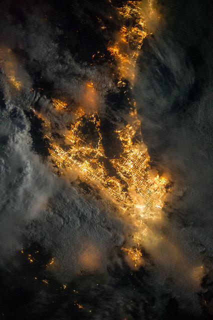
The city of Los Angeles recently finished replacing all of its streetlights with high-efficiency LED lights. They use less power, last longer, and require less maintenance than even the sodium vapor lights — an all-around win. They also cast a slightly bluish light, eliminating the amber look of sodium. But my first thought was that with all that work, they could have taken the opportunity to combat light pollution. The night sky doesn’t seem any darker than it did when we moved up to this area.

Then I took a good look at these LED street lights near work. The new fixtures actually do aim all the light downward, shielding upward leakage. They’re plenty bright from the ground, but from a few stories up, I couldn’t tell which lights were on without looking below them to see whether there was a pool of light on the ground.

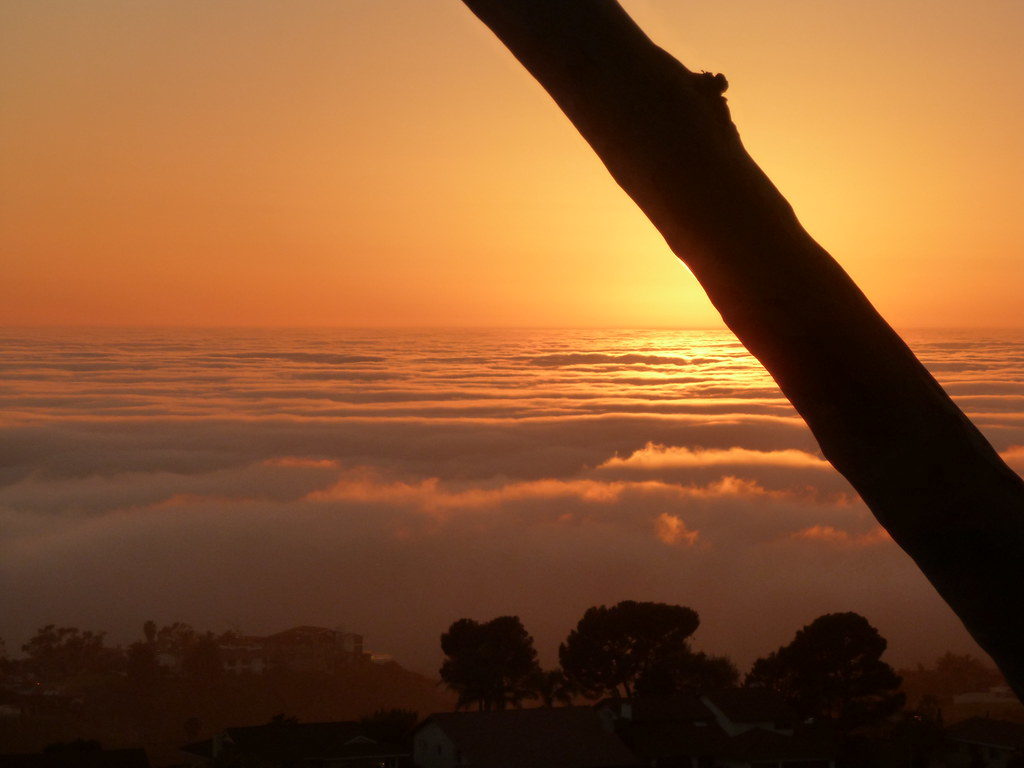
So if the streetlights really are leaking less light into the sky, why is it still so hard to see stars to the north? Seriously, I can see Orion clearly most nights, but the Big Dipper is practically impossible to pick out.

  • It was a city project, not a county one. There are plenty of other cities in the area that either haven’t been converting their lights, or have only converted a few.
  • They didn’t actually convert all the streetlights in town, just the standard, boring ones (141,089 of them). Phase 2 is converting decorative street lights.
  • There are lots of other lamps that leak light upward: Parking lots, building lights, private roads. LAX is to the north, and there’s a reason for the phrase “lit up light a landing strip.” There’s also a park nearby with a baseball field; those lights drown out quite a bit when they’re on.
  • The ongoing drought has caused smog levels to climb, making the skies hazier.

Rain lit up by a car headlight.Speaking of the drought, I found myself wondering: How much water would we save if the city did a similar project to replace all the grass along street medians, parking lot boundaries, etc. with drought tolerant native plants? A home lawn at least has a potential use as a gathering place, or a play area. But a little strip of lawn six feet across? What’s the point?

And what do they do with medians out in the high desert, anyway? I remember driving out to Joshua Tree once and noticing in one of the towns along the way that all the houses were built on a standard suburban lot plan with space for a lawn, but that they used it for rock gardens, or native plants, or just left it empty. But I can’t remember what they put along the sides and middles of city streets.

And that gets me to the other article: It was a summary of a study on the vulnerability to climate change in various parts of the region. Most of LA will handle a rise in sea level fine, except for the beaches, Marina del Rey, and San Pedro…but depending on how the climate changes, most of LA would be vulnerable to severe flooding.

In any given decade in California, you can expect at least one drought and at least one winter of heavy rains and flooding. And sometimes those floods can be spectacular. A flash flood in 1825 changed the course of the Los Angeles River (it used to flow into what’s now Marina del Rey). And then there’s the Great Flood of 1862, which covered huge swathes of California and Oregon with water, including all the lowlands of what are now Los Angeles and and Orange County.

So in addition to planning for drought, the region also plans for the occasional flood — unfortunately, by trying to channel all that water out of the way as quickly as possible, because, as the study pointed out, more than 80% of the ground in the area is covered with impermeable surfaces — you know, asphalt, concrete, buildings, etc.

They do have spreading ponds to replenish groundwater from at least part of the storm drain system, but a lot of that water just goes straight into the ocean, and in heavy rains, the ponds get overwhelmed anyway.

It just seems like there ought to be a better way to capture the rain we do get.

Southern California at night from space (via NASA).

Last night, I saw more stars than I’d seen from home in years.

I’d just gotten back from a midnight grocery run (on which I’d had the disorienting experience of watching a three-quarter moon rise — talk about a “grin without a cat”), and the combination of recent rain, fewer house lights at that hour, and my own dark-adapted eyes made the night sky look more like what I remember from home in the suburbs when I was younger.

It was still depressingly few stars compared to those times I’ve been out camping in the desert, or even the time we went to San Simeon and I drove out of town a few miles to try to spot a comet (it didn’t work)…and nothing on the time we stopped in the middle of the Ka‘u lava fields on Hawai‘i. But it was enough that I could make out part of Orion’s arm and club, which is a lot more than I usually see here in the southwest of Los Angeles. If the moon hasn’t risen, Juipter would have dominated the view, and it seemed as bright as Venus had been just after sunset, though I now know that’s an illusion of memory. Even the Hyades were clear.

Of course, that was only in part of the sky: straight up, to the south, and to the west. North and east faded into the general haze of light from greater Los Angeles. Even the Pleiades, sadly, used to be easy to spot, but I could barely pick them out.

Earlier in the evening, I’d tried to point out Orion and Cassiopeia to my almost-three-year-old son, but he’d been completely uninterested. I wonder: Have I missed the window to show him how awesome the night sky can be?

On my flights up to San Francisco and back a few weeks ago, I noticed that the Los Angeles area at night, rather than being mostly dark with islands of light, is mostly light with islands of dark: the mountain ranges and hills. Today I stumbled on a photo from space that really demonstrates it: Artificial Light, taken by, well, it doesn’t actually identify the astronaut, but since it’s credited to NASA and dated July 21, 2013, it’s probably Karen Nyberg (unless the site is confusing it with this shot of hers).

In this image, south is up and north is down. San Diego is at the top of the frame. The lower half is Orange County, the Los Angeles basin, and the San Gabriel Valley. The Santa Ana Mountains form an empty gap in the middle, bordered by the communities along the I-15 to the left. A narrower gap, Chino Hills and connected hills, extends downward to the right, ending at a bright spot that marks Downtown Los Angeles. The San Fernando Valley is covered by clouds, though you can see a glow from beneath. I had no idea Hemet had grown so big.

I grew up next to that empty area in the middle, and at the time it was even bigger. A lot of farmland and open space has filled in over the last 25 years. And all those street lights leak light upward into the sky, where it scatters and hides more and more stars.

We don’t need all that light leaking into the sky. It doesn’t help visibility down on the ground, it’s a waste of energy…and it hides what used to be a basic source of wonder that anyone could experience.

Yesterday I looked at the moon and Jupiter and thought, there’s going to be another conjunction tomorrow, isn’t there? Then I forgot, but fortunately I had to make a grocery run and looked up.

For this second shot, I zoomed out and let it overexpose the moon so I could get the bright star Aldebaran in the photo as well. It was a bit easier than the really good one in January, because the crescent moon isn’t as bright (less area shining at us), so it didn’t overwhelm the stars and planet quite so thoroughly.

As I post this, it’s been about half an hour, so if you’re in the western half of North America and the sky is clear, you can walk outside RIGHT NOW and see this!

After a failed attempt yesterday, I was even more determined to try to spot comet Pan-STARRS tonight when it would appear near the moon. Naturally, the morning was fogged in, and the fog bank remained on the western horizon all day. I looked on Google Earth for a nearby hill with a western view and public access, and I found Fred Hesse, Jr. Park in Rancho Palos Verdes.

I arrived just minutes before sunset, and found thirty or so people lined up along the western edge of the hill with telescopes, binoculars, and cameras on tripods. It reminded me a lot of the eclipse I watched last May (also in Palos Verdes, though at a different park).

Hesse Park has a clear view to the west and southwest, with open space below, then houses, then the tops of the clouds. (I’m not sure what’s usually visible below the cloud layer). Off to the southwest you can see the northwestern section of Catalina Island. To the north you can see Malibu and the Santa Monica Mountains. Way off to the northwest you can see some of the channel islands.

Continue reading