A gate across a two-lane road heading downward through the hills.

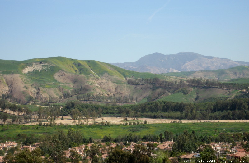
I’ve been looking through photos from back when we could, you know, go places and found a set from the hills above North Tustin during a year that we got enough rain to turn the hills green. There were some really clear shots of Peters Canyon, Saddleback, and even some south Orange County hills that I couldn’t identify. There was a spot that I remember being a turn-out that’s finally eroded away to the point that it’s been fenced off.

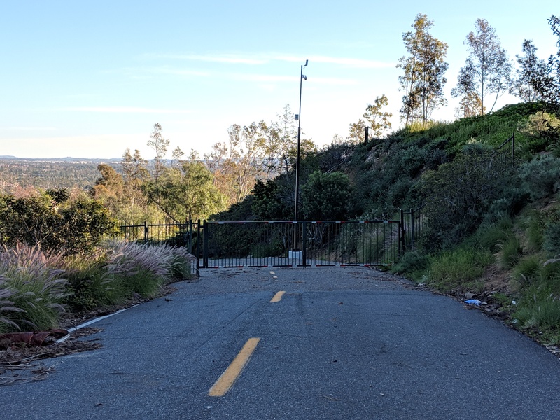
And there was this gate, which I think might have been across the road to Camp Myford, a Boy Scout camp on the Irvine Ranch that closed back in the late 1980s. I remember working as a camp counselor for a Cub Scout day camp during the last month — possibly the last week — it remained operating, before the bulldozers came in.

I remember lots of eucalyptus trees, hiking trails and dirt roads, a couple of buildings (though I couldn’t tell you what was in them), a fire ring, and a whole lot of giant pipes that were going to become the sewers and storm drains of the housing tract that was going to be built any moment now. And I remember being told in no uncertain terms that we were supposed to watch our language around the impressionable younger boys (who were, of course, a lot more foul-mouthed than we were).

And I found this article through the Tustin Area Historical Society, summarizing the history of the canyon as far back as the Mexican Rancho system, when it was named CaƱon de las Ranas (Canyon of the Frogs) because it drained into the Newport Back Bay, known then as the Marsh of the Frogs.

Old photo of Camp Myford gate and sign over a dirt road.Peters Canyon was once Canyon of the Frogs
Camp Myford, an Irvine Co. gift to the Orange County Council Boy Scouts of America, was named for James Irvine’s youngest son. Peter’s Canyon Regional Park offers a well-used oasis of wilderness amid the sprawl of development in the North Tustin area…

A fire is raging in the hills and canyons of Orange County. It’s nothing compared to the devastation in Northern California, where 160,000 acres have burned, killing 21 people and wiping out whole neighborhoods in Napa and Santa Rosa — but a dozen homes have been lost and about as many damaged in the 8,000-acre blaze near Anaheim.

Even though I live farther away now, the smoke still reached the coast on Monday, the first day of Canyon Fire 2 (so-named because it picked up where the Canyon Fire left off last month). It turned the sun orange and the sunlight yellow, like sunset but at too high an angle. The smoke is a lot more diffuse now, looking more like typical smog, and firefighters are getting the fire under control as the weather changes.

The evacuation maps and the photos of Peters Canyon remind me of the Santiago Fire ten years ago this month. That fire burned for nearly three weeks and scorched 28,000 acres. I wondered whether they ever caught the arsonist who set it. As far as I can tell from a quick search, they never did. The most recent article I found was on the five year anniversary of the fire. At that time, they had “narrowed the search to three suspects…but no arrests [had] been made.”

October is always a bad month for wildfires in California. Plants have been drying out all summer, the winter rains haven’t started yet, and the hot, dry seasonal winds of fall — Santa Anas in the south and Diablos in the north — whip up the flames and drive them long distances. But in the last decade, more and more fires have burned large areas in summer, spring, and even winter, to the point where “fire season” may as well be year-round.

A couple of weeks ago I just had to get out of the house for an afternoon and found myself at the entrance to Peters Canyon Park. The last time I’d been there, the park was closed due to recent rains. This time, it was open.

Several trails run from the entrance around the edge of the park, and one goes inward to an area that’s currently closed off. Because…well…take a look:

Damaged sign: Warning - Mountain Lion Country

I couldn’t help but take a picture. It went so perfectly with this sign I found in Hawaii near the active lava flows: Continue reading

Back in October, shortly before the Santiago Fire, I went sightseeing in the Tustin Foothills and snapped a picture of Peters Canyon, the hills behind it, and Saddleback in the background. A month later, I took a picture of the same view after the fire and posted the two as a before and after comparison.

Well, we’ve had several months of normal (for SoCal) rain, and the hills have turned green. Mostly. It’s clear that the scars from the fire are going to take at least another season to heal. The last couple of days have been very clear, so I went back to the same spot to take a “four months later” photo.

Mt. Saddleback seen from Tustin foothills, March 2008
March 10, 2008. Click for a larger version

Now compare it to the November (post-fire) and October (pre-fire) photos: Continue reading

Found this while wandering around the Lemon Heights area a few weeks ago, looking for scenic viewpoints. It’s on the Skyline trail, near Peters Canyon park.

Yield sign with 3-way diagram with icons and arrows.

It seems to be saying this:

  • Cyclists* yield to pedestrians and horses.
  • Pedestrians yield to horses.
  • Horses yield to no one.

But if you’ve never seen it before, the meaning isn’t clear at a glance.

Apparently the idea is to make everyone stop and try to work out the diagram, so that they can start moving again in the right order.

*Or perhaps only bicycles, since there’s no rider in the picture.