Today’s Astronomy Picture of the Day is an incredible long-exposure picture of star trails above Mauna Kea:
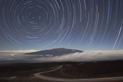
I think the picture says it all.
Today’s Astronomy Picture of the Day is an incredible long-exposure picture of star trails above Mauna Kea:
I think the picture says it all.
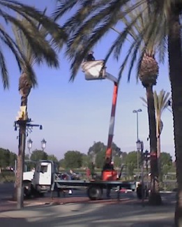
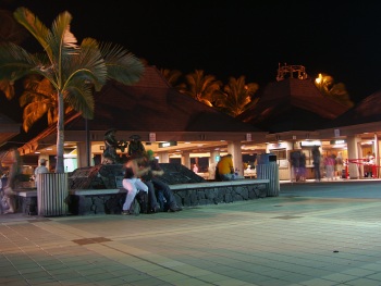
I spotted workers trimming the palm trees at lunch today. In Irvine, that involves a bucket crane and a chainsaw, with a couple of guys on the ground to pick up the fallen fronds and pile them off to the side.
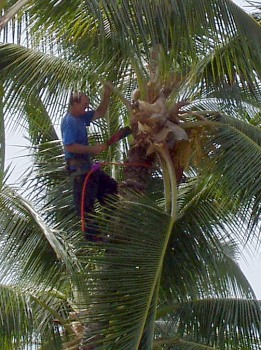
This contrasted heavily in my mind with the tree trimmers I saw in Hawaii, where a guy would shimmy up a palm tree with a rope and a machete, then hack away.
I saw them rotating the crane to move the guy to a new tree, so I’m sure the mainland style trimming gets done faster than the island style… but then, we’re always in such a hurry here. Too bad we can’t do our landscaping on island time.
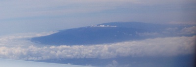
Here’s our first view of the island of Hawai‘i, as our plane approached on Sunday morning, April 3. Snow-capped Mauna Kea is rising out of the clouds, with Mauna Loa behind it.
A week later, we spent Sunday evening waiting for our flight out of Kona Airport. (After a disastrous experience at LAX in which we arrived 2 hours ahead and got to the gate with maybe 15 minutes to spare, we showed up early for the flight home. But Kona’s much smaller and better organized, so it took us maybe 15 minutes to check in. There wasn’t even a line to go through security!)
I hope you’ve enjoyed this series on our Hawaiian vacation. I’m sorry it took so long to finish it, but hey, I managed (just barely) to beat the 6-month marker!
There was one morning in Hawai‘i that the clouds in Kona cleared and we could actually see something of Hualalai, the volcano that makes up the western side of the island and on whose slopes we were staying. Here’s the view from our hotel room balcony.
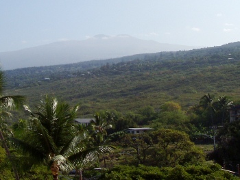
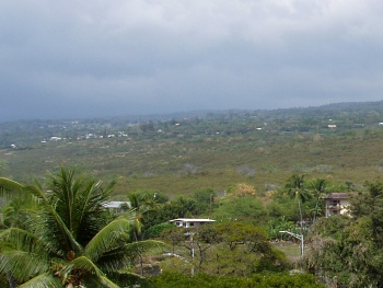
Usually it looked more like this:
Note: Our stay in Kona was April 4-10, 2005
Flashback to April and Hawaii. On the day we drove to Kilauea we stopped at various places along the way. And since it’s a nearly-100-mile drive from Kailua, there was a lot to see.
We never made it down to South Point (the southernmost tip of the island), partly because of time and partly because—believe it or not—our car rental contract forbid us to drive on the 12-mile road out to the point! Supposedly it’s poorly maintained—or it used to be, and the policy hasn’t kept up—and they don’t want the wear and tear on cars that aren’t designed for it. As I recall, rental trucks and SUVs don’t have the restriction. This was the closest we ever came to it, and you can only barely see it way off in the distance.
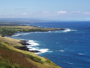
If you look at the end of the spray near the visible point, then go straight up toward the horizon, you’ll notice that the sky-sea line dips downward slightly and there’s a faint darker patch of sky. As far as we could tell, that’s the promontory heading out toward South Point. Even then, we weren’t quite sure. Update: It’s not. I checked the map when I finally uploaded these images to Flickr, and the highway doesn’t get close to the ocean on the west side. It’s a viewpoint near Haleokane, east of Naalehu and east of the turnoff to South Point Road. We’d already passed it!