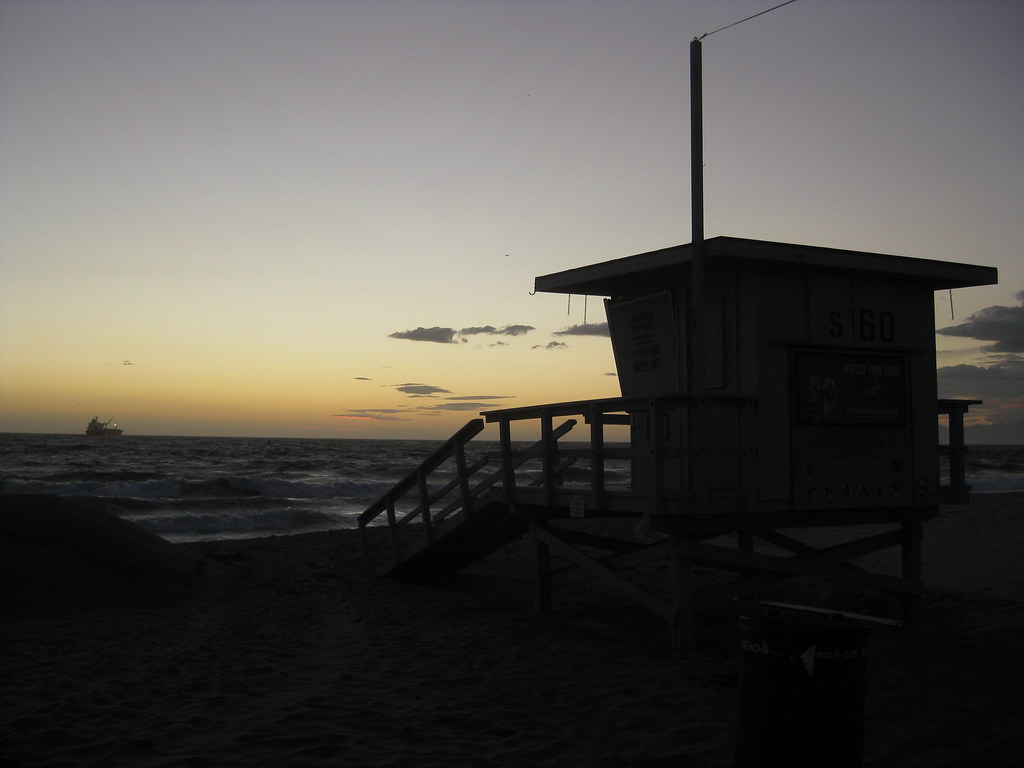
A rainstorm hit Los Angeles today and cleared up in some parts of the region during late afternoon. After work I made a beeline for the nearest beach to catch the sunset, which happened to be Dockweiler Beach at the end of Imperial Highway.

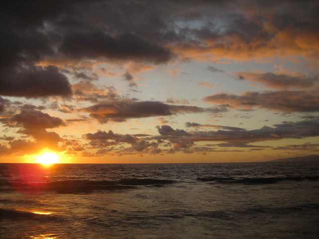
The beach was absolutely deserted when I arrived (not counting the gatekeeper who dutifully collected $6 for parking), which made sense — it had been a cold, rainy day in November, and it was almost sunset besides. The sand was all wet, covered with tiny little pockmarks from the rain.

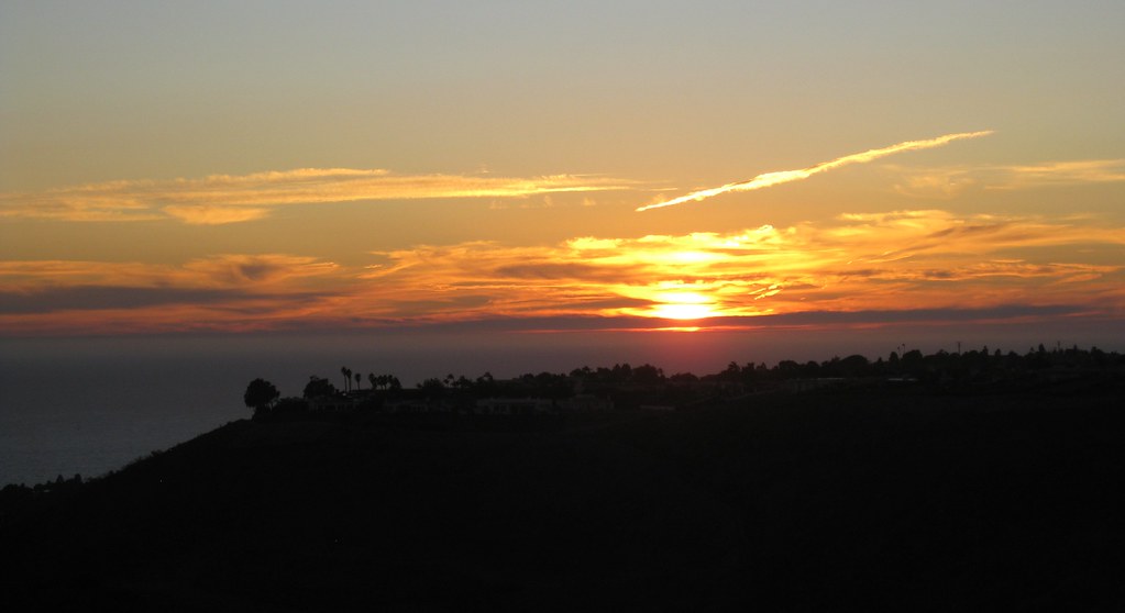
Rain was still falling in Santa Monica to the north and somewhere inland in the South Bay — possibly Torrance or Redondo Beach. Lit from the side, Santa Monica looked like there was a golden haze above the city. Continue reading

It’s been six months since we moved, but I’ve only recently started really exploring the area. I think I just got caught up in too much other stuff for a while.

One day a few weeks ago, I tried to make it to the nearest beach I could in time for sunset. I missed…but while on the mostly-deserted beach I caught some nice views of pink underlit clouds over the Santa Monica Mountains, and this view of a closed lifeguard tower at El Segundo Beach.

Then there was the clear afternoon when I went exploring the Palos Verdes area, looking for public parks where I could see the LA basin. Not much luck on that count, but as sunset approached, I decided to see if I could make it up to Del Cerro Park (more photos from this spot taken during daylight) up at the top of the bluffs. I did, and because the park is actually higher than the next hill over, I got to watch the sun set over the ocean and behind a hill at the same time.

I stayed up there for a good 20 minutes after sunset, watching the sky darken through twilight. It was incredibly windy that evening, and even from a thousand feet up with no direct sunlight, I could still watch the waves between the mainland and Catalina Island, moving slowly through the strait like tiny ripples in the direction of the wind.

In early August, we went up to Santa Monica to visit my brother and his colleagues as they returned to Florida from Wikimania 2007 in Taipei… with a 10-hour layover at LAX.

We carpooled with my parents, and arrived while the group was still stuck in customs. So we wandered around the Santa Monica Promenade and pier for a bit. Not surprisingly, there were some strange things about, like this turtle-themed drinking fountain.

Turtle and drinking fountain

Then there was this sign, on the Johannes van Tilburg Building, which I couldn’t quite decide how to take. “Free Will?” “Free Willy?”

Frey Wille

The most disturbing was probably this mash-up of two movies on one of the many theaters on the promenade:

Marquee: Knocked Up, Bratz

Is the American public ready for that film?

There are topiaries sculpted into the forms of dinosaurs scattered along the promenade. This stegosaurus came out the best:

Stegosaurus topiary

As I mentioned, we did wander out to the Santa Monica Pier after a bit. Nothing terribly odd, just a couple of photos to set the scene:

The pier viewed from the cliffs

Santa Monica beach and cliffs, seen from the end of the pier

Flashback to April and Hawaii. On the day we drove to Kilauea we stopped at various places along the way. And since it’s a nearly-100-mile drive from Kailua, there was a lot to see.

We never made it down to South Point (the southernmost tip of the island), partly because of time and partly because—believe it or not—our car rental contract forbid us to drive on the 12-mile road out to the point! Supposedly it’s poorly maintained—or it used to be, and the policy hasn’t kept up—and they don’t want the wear and tear on cars that aren’t designed for it. As I recall, rental trucks and SUVs don’t have the restriction. This was the closest we ever came to it, and you can only barely see it way off in the distance.

Coastline with coves and points

If you look at the end of the spray near the visible point, then go straight up toward the horizon, you’ll notice that the sky-sea line dips downward slightly and there’s a faint darker patch of sky. As far as we could tell, that’s the promontory heading out toward South Point. Even then, we weren’t quite sure. Update: It’s not. I checked the map when I finally uploaded these images to Flickr, and the highway doesn’t get close to the ocean on the west side. It’s a viewpoint near Haleokane, east of Naalehu and east of the turnoff to South Point Road. We’d already passed it!

Continue reading

We didn’t get to see much of the Hilo side of the island. Our last day there, we checked out of the hotel and just started driving, figuring we’d just see how far we could get before turning back to make our flight. We did actually make it to Hilo itself—just in time to turn around. (It was a Sunday anyway, and supposedly there isn’t much open in Hilo on Sundays.)

When we first crossed through Waimea to Hamakua, we took a side trip north to the lookout for Waipio Valley. The valley itself is unreachable without 4-wheel drive (the road has a 25% grade), but the view from the lookout was incredible:

Waipio Lookout

Continue reading