Probably the influence of the Hawai‘i sign across the street, but I could swear the song on the radio was “My Kind of Lava”
Tag: lava
Hot and Fresh!
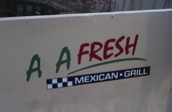
‘A‘a fresh? Hmm, that makes me think of something more like this:
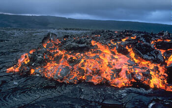
(Image courtesy of the US Geological Survey)
No thanks, I think I’ll stick with the mild salsa on this one.
Edit: For the benefit of out-of-state readers, the sign’s for a restaurant called Baja Fresh.
Thurston Lava Tube (Nāhuku)
Let’s see, when we left off, we had nearly completed a circuit around the Kilauea caldera. Before driving down Chain of Craters road to the coast, we stopped at the Thurston Lava Tube. Update (2021): The park is now emphasizing the Hawaiian name for the cave, Nāhuku, but at the time we visited in 2005, all the labels we saw still called it Thurston Lava Tube.
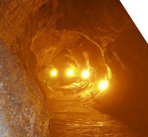
Lava tubes are formed when smooth a’a lava flows through a channel, then crusts over. The still-molten lava underneath keeps flowing until the source stops, and it drains out, leaving a long tubelike cave.
We were lucky in that there were very few other tourists there at the time. (It was the first week of April, which isn’t exactly the height of Hawaii’s tourist season.) The Thurston tube is famous partly because of its size, and partly because it’s very easy to get to. It’s less than a quarter-mile walk from the road.
A Visit to Kilauea
Picking up the oft-delayed vacation photos series, here’s the first half of our trip out to Hawai‘i Volcanoes National Park and the volcano Kilauea.
Kilauea is often referred to as the most active volcano in the world. To give you an idea why, its latest eruption started in 1983… and is still going!
We got to the park fairly late in the day, partly because we underestimated the amount of time it would take to drive there from Kailua, and partly because we stopped at various points of interest along the way. It was mid-afternoon by the time we got to the visitor’s center, where Katie stood transfixed by the lava videos and I checked out the maps.
We stopped for a late lunch at Volcano House, an old hotel built on the edge of the Kilauea Caldera. Check out the view!
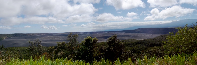
The crater Halema‘uma‘u, which contained a boiling lava lake from 1823–1924, is visible near the center. The southern slope of Mauna Loa rises in the background. The whole caldera is roughly elliptical in shape, and Volcano House is one end of the longer axis. I don’t remember exactly how far it is from one side to the other, but judging by the map I’d say it’s about 2×3 miles.
Off to the right, behind a tree in the panorama, are the steaming bluffs. Groundwater gets heated by the magma below the volcano and seeps out through cracks all over the caldera.
Continue reading
Lava Graffiti
Amid the old lava flows on the west coast of Hawai‘i, locals have a tradition of arranging coral on the jumbled rocks to create temporary graffiti. It tends to be “friendly” graffiti, more like carving one’s initials in a tree than tagging a freeway wall with spray paint.
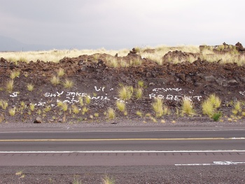
We drove past a beautifully drawn whale several times before we finally decided to stop by the side of the road, and Katie stepped out to get a picture:
Continue reading