This sea otter likes long swims along the coast, kelp forests…and stealing surfboards. (LA Times)
“At first, we were like, ‘Look how cute?’ But then it bit down on the board and chewed off a piece, and we were like. ‘What’s going on?’”
This sea otter likes long swims along the coast, kelp forests…and stealing surfboards. (LA Times)
“At first, we were like, ‘Look how cute?’ But then it bit down on the board and chewed off a piece, and we were like. ‘What’s going on?’”
The “Today’s Outlook” section of the California electricity ISO shows detailed trends and breakdowns of how much electricity is available from which sources over the course of the day, and both actual and projected demand.
You’d think demand would be highest during the hottest part of the day, but it’s early evening, when people are getting home and turning on their own air conditioners. Just as solar is fading.
Last weekend, a lot of people in the Los Angeles area tried to go hiking, or to the beach, or otherwise outdoors…to the same places. Which ended up creating the crowds that the shutdown was supposed to prevent, just in different places. 🤦♂️
So over the last few days, various cities, counties and the state have closed a bunch more parks, beaches, hiking trails and bike paths. It’s still OK to walk in your neighborhood as long as you keep your distance from people, but destination-based going outdoors is mostly off the table now.
Meanwhile the coronavirus continues to spread, and cases continue to climb, driven by people who were exposed before “social distancing” became a thing as they start developing symptoms. And in some cases succumb to them.
It’s been almost three weeks since I last went for a photo walk or a hike in anything resembling more nature than a patch of weeds in someone’s lawn. It feels like a year ago. And they just closed that beach and the paths along the bluffs.
Though I’ve got to say: in retrospect I’m relieved that I couldn’t find parking closer to the pier because of the kite festival, and ended up at a less crowded part of the beach. I could have gotten exposed to Covid-19 the same day the flu hit me, which would’ve been a really fun one-two punch. As it is, the whole household has been mostly isolated since then, and not only have we avoided picking up Covid-19 as near as we can tell, but I managed to not give anyone else the flu. So that’s good.
Back to the outdoors, though. Over the last year or so I’ve realized that getting outside really helps me de-stress. Whether it’s a walk around the block, a search for songbirds, a hike through nature (or a reasonable facsimile thereof), or heck, a search for Pokémon, spending at least some time outside with sky and sunlight makes a difference.
It’s probably going to be mostly walks around the block for a while. Most of the open nature spaces in the area are either closed outright (Madrona Marsh, for instance), or are open but with their parking lots closed (like Hahn Park). Even the bike path where I’ve spotted hawks and scrub jays and a wide variety of plants (not just puncture vine) is closed. The South Coast Botanic Garden is still open for now, but they’ve instituted an appointment system to limit the number of people inside at a time. I’m debating trying to go this weekend. While it’s still possible.
Though to be honest, if the process of getting there and back induces too much anxiety, it’ll pretty much defeat the purpose.
On Thursday, Los Angeles County ordered that everyone stay at home except for essential activities like buying food, getting medical care, taking care of someone, or going to an “essential” job. Later that evening, California issued a similar order.
But something was unclear: The county specifically mentioned that the guidelines didn’t apply to just going out to walk your dog, hike, or get exercise as long as you maintained your distance from other people and didn’t try to use facilities that were closed, like playground/gym equipment. The state didn’t.
And while I’m reasonably certain that we’re not at the point where they’re going to be arresting or fining people just for walking around the block, I don’t want to be like the guy who explained to Italian police that “I have to hunt the Pokemon” when they charged him for breaking quarantine.
State officials clarified it to the press on Friday:
“Californians can still go hiking and biking outdoors without violating Gov. Gavin Newsom’s “safer at home” order issued Thursday, state officials say. Though many activities have been curtailed to prevent the spread of coronavirus, going outdoors isn’t one of them.”
Good – that explains why South Coast Botanic Garden sent out the notice that they were still open for hiking despite cancelling events. They have stopped taking payments at the gate, though, which is understandable.
And today the state’s official page on the directive features this clarification:
Can I still exercise? Take my kids to the park for fresh air? Take a walk around the block? Walk my dog?
Yes. So long as you are maintaining a safe social distance of six feet from people who aren’t part of your household, it is ok to go outside for exercise, a walk or fresh air.
For now, at least.
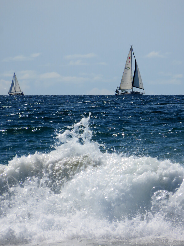
Last weekend, before the flu hit me, I tried to de-stress by going somewhere for a photo-and-nature walk. I ended up at the actual Redondo Beach, south of the pier. Partly because there was nowhere to park near the pier due to the Kite Festival, which now that I think of it may have been one of the last big gatherings in the area before everything was canceled for pandemic control.
Parking along the top of the bluffs was still pretty full, but the actual beach was only sparsely populated. Mostly people were using the walking and bike paths at the top and bottom of the bluff. I imagine I wasn’t the only one already trying to avoid crowds while still getting out.